
Your source for Mountain Biking in the Triangle
Raleigh-Durham-Chapel Hill
|
|
Your source for Mountain Biking in the Triangle Raleigh-Durham-Chapel Hill |
||||||||
 American Tobacco Trail
Description
Location: Southwestern Wake County near New Hill and runs
North to downtown Durham.
Miles: 23 Rails to Trails
Skill Level: Beginner
Contact: Park office (919) 387-2117>
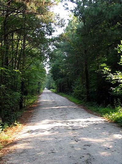
The American Tobacco Trail is a 23+ mile
rails-to-trails project located in the Triangle Region of
North Carolina. The route crosses through the City of
Durham; Durham, Chatham, and Wake counties; the planning
jurisdictions of the Towns of Cary and Apex; and passes
through the Lake Jordan project land of the U.S. Army
Corps of Engineers.
Map
Park Hours and Fees: There are no fees, Hours Sunrise -
Sunset
Directions:
Wake County:
From Pittsboro, Jordan Lake and points west, go east on US 64 to the NC 751 light. Turn right or south, go two miles to the gravel drive on the left shortly after the Beaver Creek bridge. From the South, take US 1 to the New Hill/Harris Lake Park exit. Go north on New Hill-Holliman Road to the intersection of Old US 1. Go straight onto New Hill-Olive Chapel Road approximately 3 miles, crossing the New Hope Valley RR tracks. About a 8/10 mile beyond the tracks, turn right into the gravel drive which leads to the parking area. If you cross the Beaver Creek bridge you've gone too far.
The other parking area on Wimberly Road is
designed for only personal vehicle parking because it
isn't large enough to safely accommodate equestrian
trailers. If you want to park your equestrian trailer
please go to the New Hill-Olive Chapel Road trailhead. To
access the Wimberly Road trailhead from Raleigh, Cary or
points east, take US 64 west to Jenks Road on the right.
See the Citgo convenience store at this intersection. Go
1/3 mile (mileages are approximate) to the first left.
Turn left onto Wimberly Road. Go approximately 1 mile
passing the Cary-Apex Water Treatment plant, and crossing
the White Oak Creek bridge. The trailhead is located on
the right.
Please do not access the trail by parking
on Goodwin Road or Olive Chapel Road.
The Goodwin Road crossing is in a neighborhood and the
trail is adjacent to a driveway used by several families.
If you park on the driveway or the trail, you will be
towed, as well as make a lot of people unhappy. Olive
Chapel Road is a heavily traveled, fairly high speed,
narrow road where there is no formal parking area. It is
hazardous to get in and out of your vehicle here
alongside the road. Please use the above mentioned
parking areas which are conveniently located, safe and
dedicated to trail use.
Durham County:
Maps of the Durham area
10/01/03: There is now parking for the
American Tobacco Trail in a dirt lot in front of
SouthPointe Crossings shopping center in Durham off of
Fayettville St. in Durham near the Highway 54 and I40
intersection. From the lot there is an entrance directly
on the trail which goes all the way to downtown Durham.
There are also new mile markers on the trail and signs
that show street names and trail maps. Right now the
trail ends at Highway 54 going towards Raleigh but
hopefully soon that will change.
From I-40East
Take Fayettville St Exit, turn
right on Fayettville St. Go straight at Highway 54
intersection, turn left at SouthPointe Crossings shopping
center, then turn right into dirt lot.
Rules of the Trail
Only portions of this trail are open. Most of the Wake county end is under construction and the Chatham county portion is in the planning phase. This will be a great, easy family ride through some rural areas in Wake/Chatham counties and ending up in downtown Durham near the Bull's athletic park. This page will be updated as the trail is built.
For the complete story, including maps and history, check out Triangle Rails-to-Trails.